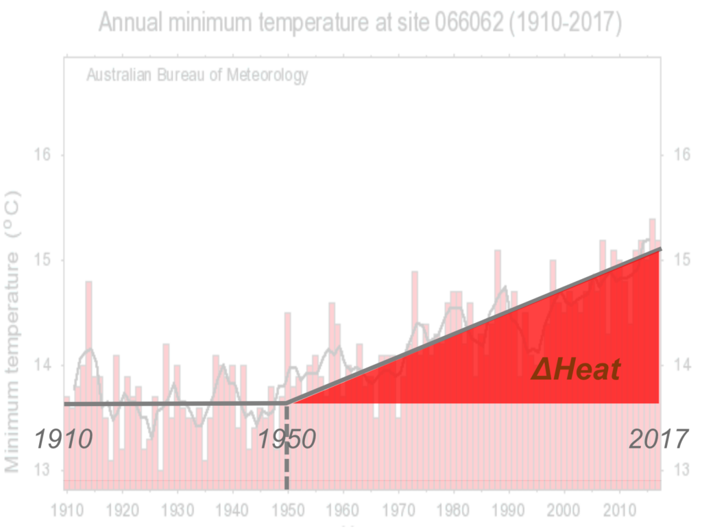
The heating of the world’s land surface since the mid-20th century has created a new landscape (atmosphere + biosphere) and specifically a new “florasphere”. The heating has changed the florasphere’s vulnerability to wildfire. The effect of the heating can be captured, and only be captured, by a new Index of Wildfire Climate-Vulnerability (WCVI); ΔHeat = ΔTemperature x ΔPeriod of heating. ΔHeat is a simple digital index which is accessible in historic weather databases worldwide, and which after a simple analysis (linear regression) of a location’s historic temperature graph, allows us to digitally link bushfire character and bushfire predictability to our experienced climate heating.
ΔHeat provides the foundation for a planning response to wildfire which accommodates climate heating. ΔHeat can become the international tool for normalising all jurisdictions’ climate history, which will permit internationally-baselined quantification of bushfire vulnerability everywhere.
ΔHeat is the quantitative proxy for climate heating in all atmospheric and biospheric systems. At its broadest, ΔHeat is simply an “atmospheric heating vulnerability index”. It has equal capacity to measure cumulative heat in (1) atmospheric systems (climate heating, bushfire prediction), (2) ocean systems (marine heatwaves, icecap-water dynamics), and (3) biospheric systems (eg species evolution, species vulnerability). ΔHeat has been employed to map Australia’s climate heating regime (Laing, separate post): Stage 1 cooling (pre-1956) then Stage 2 heating (1956 – present).